

You can find on this page the map of Amsterdam tram. Amsterdam tram is a transit system serving the city of Amsterdam (Netherlands) with the subway, the bus or the ferry. The tram network has 15 lines and 500 stations forming a rail network of 50 miles (80,5 km).
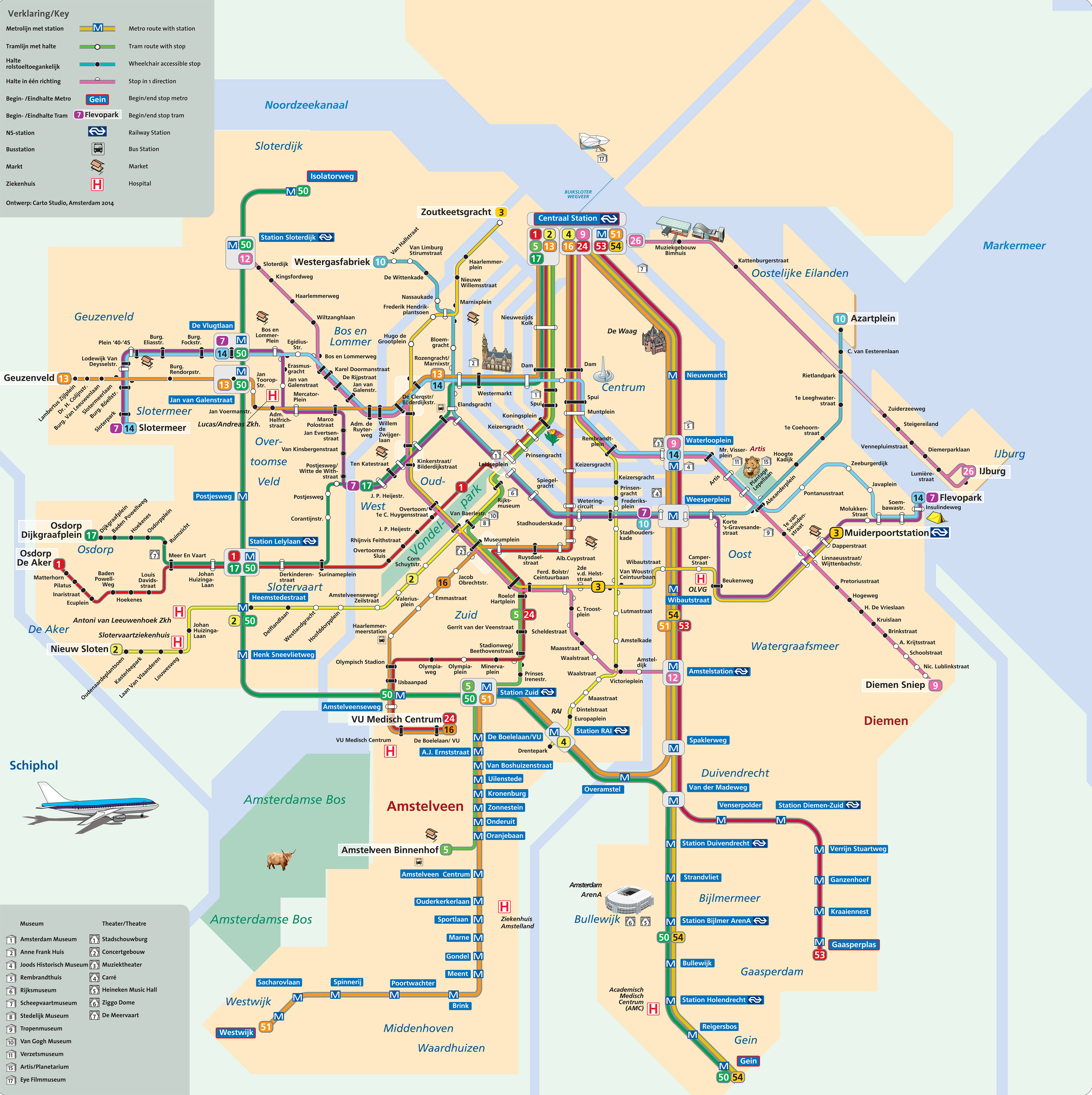
Amsterdam trams exist since 1900 and are operated by the GVB (Gemeentelijk Vervoerbedrijf).
Its network includes the following 15 lines:
• Line 1 : Centraal Station ↔ Osdorp De Aker
• Line 2 : Centraal Station ↔ Nieuw Sloten
• Line 3 : Zoutkeetsgracht ↔ Muiderpoortstation
• Line 4 : Centraal Station ↔ Station RAI
• Line 5 : Centraal Station ↔ Amstelveen Binnenhof
• Line 7 : Slotermeer ↔ Flevopark
• Line 9 : Centraal Station ↔ Diemen Sniep
• Line 10 : Westerpark ↔ Azartplein
• Line 12 : Station Sloterdijk ↔ Amstelstation
• Line 13 : Centraal Station ↔ Geuzenveld
• Line 14 : Slotermeer ↔ Flevopark
• Line 16 : Centraal Station ↔ VU Medisch Centrum
• Line 17 : Centraal Station ↔ Osdorp Dijkgraafplein
• Line 24 : Centraal Station ↔ VU Medisch Centrum
• Line 26 : Centraal Station ↔ IJburg


