

You can find on this page the map of Amsterdam metro. Amsterdam metro, subway, tube or underground is a transit system serving the city of Amsterdam (Netherlands) with the tram, the bus and the ferry. The metro network has 4 lines and 52 stations forming a rail network of 25 miles (41 km).
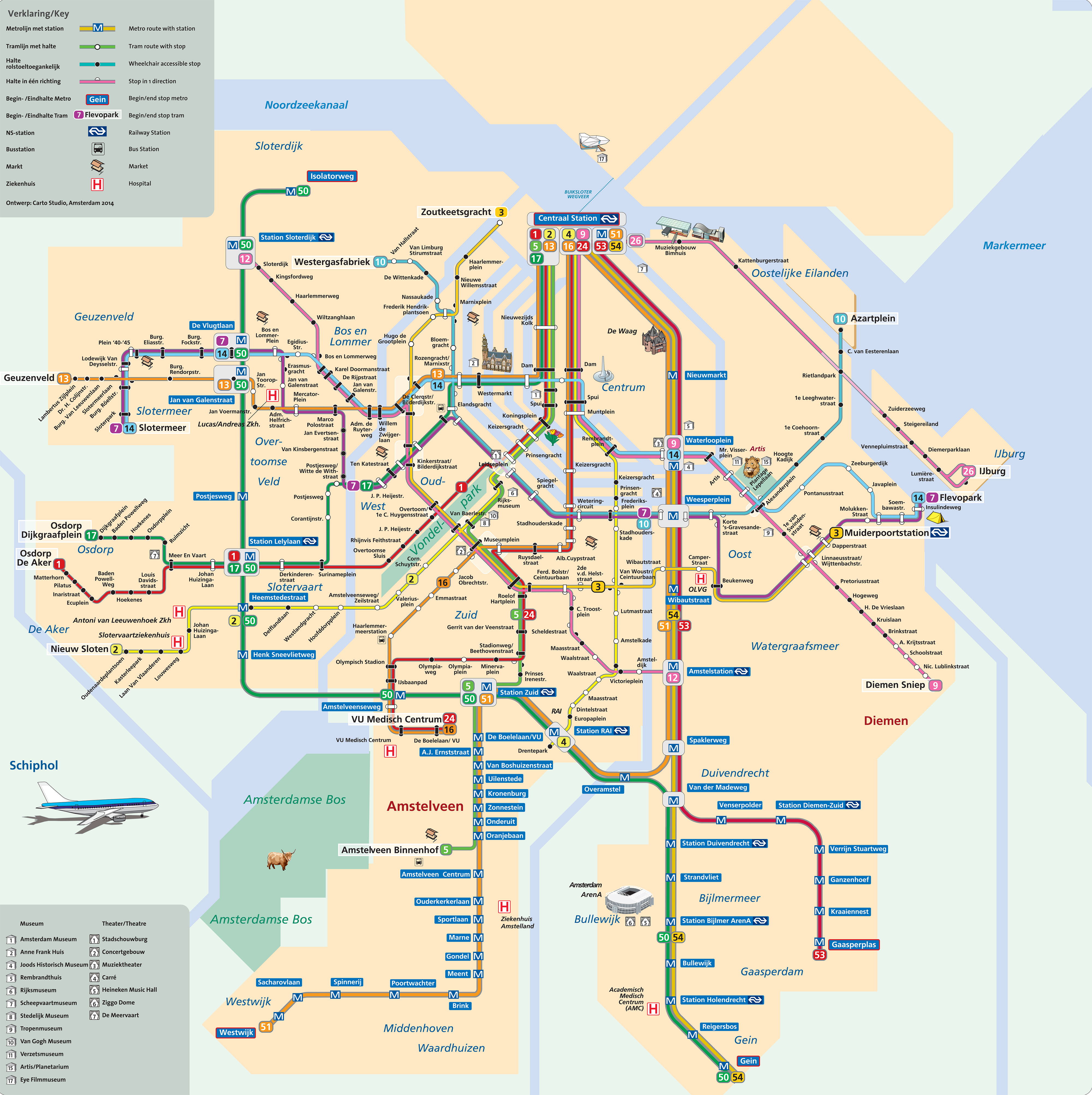
Amsterdam subways which transport 59,5 mllion passengers per year, exist since 1977 and are operated by GVB (Gemeentelijk Vervoerbedrijf).
Its network includes the following 4 lines:
• Line 50 : Isolatorweg – Gein
• Line 51 : Westwijk – Centraal Station
• Line 53 : Gaasperplas – Centraal Station
• Line 54 : Gein – Centraal Station


